“Landscape Ecology”
2010-2015, Jakarta
Futures Cities Laboratory (FCL)

The Ciliwung River has been at the center of human settlements since at least the 4th century A.O. Culturally and politically, it has been the most important of the 13 rivers flowing through the megacity of Jakarta, but centuries of exploitation and, more recently, haphazard urbanisation, have left the river a heavily-polluted, flood-inducing eyesore. Economic pressure is leading to residential and agricultural development in what were once ecological buffer zones of the middle and up per catchment. While changes in these areas affect Jakarta downstream, they are outside of the provincial government’s jurisdiction. Informal settlements along the river have adapted to chronic flooding conditions, but at the same time, they rely on the river to compensate for a lack of water, sanitation, and even recreational infrastructure. The social and ecological complexity of this system has thus far stymied any efforts at remediation.
Our methodology attempts to respond to this complexity through an iterative approach strongly based on conceptualisation and mathematical modelling. We investigate the possibilities of river corridor rehabilitation, focusing on the full range of benefits that an urban river can provide. Our interdisciplinary team conducts research at three spatial scales to better capture the dynamics of the river and its surroundings. At the catchment scale, we focus on the hydrology of the watershed and the ecosystem services-benefits to humans-it provides to the region. At the river corridor scale, our detailed mathematical models provide insight into how future changes in the river and adjacent lands may affect the quantity and quality dynamics of the water. We employ advanced 3-D terrain modelling and landscape visualization as a unique platform to generate, test, and analyze possible topographic and hydrographic changes to the river corridor. At the local site scale, our detailed investigations at urban, sub-urban, and rural sites provide a more sophisticated understanding of human-environment interactions along the river and the potential for alternative landscape configurations and designs that could contribute to re
habilitating the corridor. To define a coherent long-term vision for the river, we integrate our research through iterative scenarios, where the mathematical models are used to provide initial outputs that can help set ‘boundaries’ for planning and design. Feedback from stakeholders including residents, community organizations, and resource managers helps to refine the range of possible designs and prompt a second iteration with the models. Through this process, the team is developing a transformative understanding of the river that is both culturally respectful and ecologically congruent. Beyond this initial case study, the work aims at defining sound ways to in
fluence the course of rivers in similar demographic and socio-economic contexts.
DESIGN RESEARCH STUDIO
The Design Research Studio (DRS) run jointly by ETH Zurich and NUS have made a significant contribution to the reconnaissance, surveying and documentation of the site under study – Ciliwung River/ Kampung Melayu, Jakarta – including diverse approaches to analysis and design in this difficult context. These have led to the realisation that conventional measures of urban planning, landscape design, water engineering and flood protection are doomed to fail, because of the indescribable complexity of the problem at hand. The Ciliwung River has become the living symbol of the massive environmental crisis of Jakarta. The DRS approach has reacted to this reality in different ways, for instance, NUS DRS studios switched from ‘fighting against the flood’ at the beginning to designing a ‘City in the
River’. Three consecutive design research studios at NUS and one at ETH Zurich generated rich output that contributes further to research and design for the whole module.

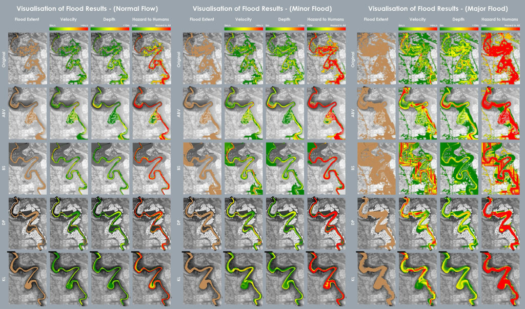
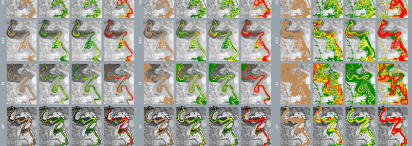
Image above: Flood simulation of four different bathymetric design models for the Kampung Melayu neighborhood, with the reference model on top. Here, the descriptive (designed) models are also used as predictive models to run various flood events through a series of computer simulations with widely varying results.

