
Topology – Spring Semester 2024
Hours: 2 hrs, on Thursdays 15:45-17:30
Room: LVML PC-room HIL H40.8 and AV-room HIL H40.5/7
Lecturers: Matthias Vollmer, Fabian Gutscher and Philipp Urech
WOLFBACH
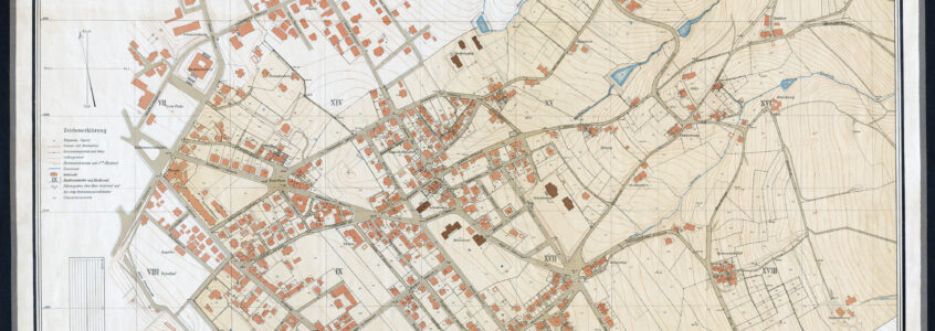
Maps from the 1850s show that approximately 160 kilometers of open streams flowed through the city of Zurich. Until the 1860s, the Wolfbach ran as an open stream through Hottingen in the direction of the current extension of the Kunsthaus before traversing the grounds of the Barfüsserkloster monastery. However, many of these streams were seen as an obstacle to the development of the city as well as a threat to urban health and hygiene. With the expansion of the settlement areas, watercourses were used for draining sewage water and disposing of waste, which resulted in unpleasant odors and sight within the city borders and consequently led to the covering of many streams. The lower segment of the Wolfbach was culverted in 1870. The resulting Wolfbachkanal still exists today and is one of the oldest canals in the city.
Image: detail of the 1865 map of Zurich, showing the open stream Wolfbach. After passing through Hottingen, the stream flows through the Wolfbachbassin, the Franciscan friary Barfüsserkloster and the Niederdorf before merging into the Limmat. Source: BAZ “C249_5”
In 1926, the city of Zurich began to treat wastewater with the opening of the first sewage treatment plant. In the following decades, the watercourses were gradually cleared from unwanted impurities while remaining buried. In 1980, there were only around 80 kilometers of open watercourses left in the city of Zurich – most of them in wooded areas. What remained were numerous street names that refer to the open streams of the past: Bachtobelstrasse, Lindenbachstrasse, Hegibachstrasse and others. To date, the municipality has developed a new concept for watercourses in the city and has carried out around 50 projects to open up or renaturalize streams and thus uncovered around 16 kilometers of watercourses. In this course we want to try out a new method of changing the urban landscape and return the Wolfbach to daylight!
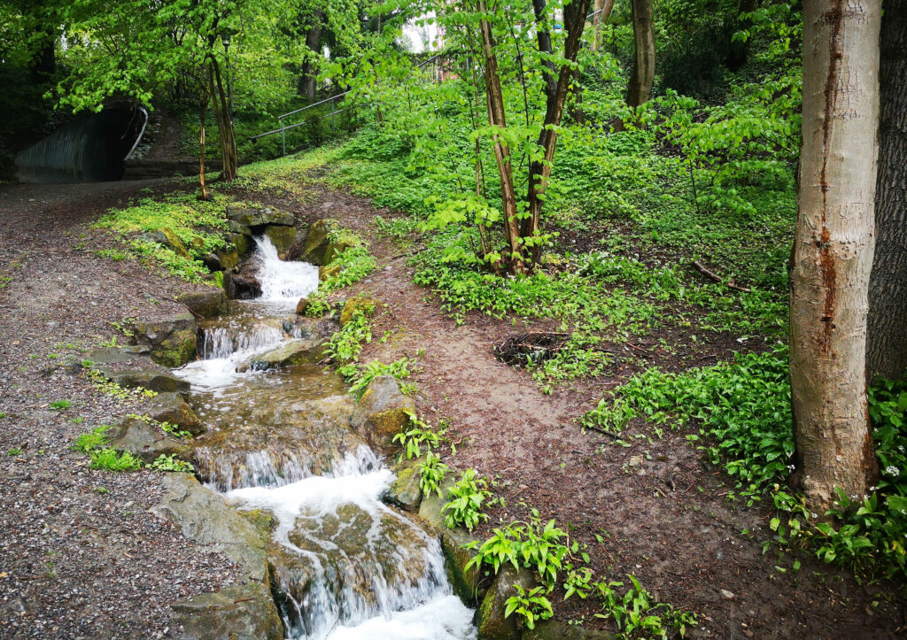
Picture: Wolfbach in Hottingen, before dissappearing under the Dolderstrasse.
CONTENT
The goal of this course is to expand the perception of urban streams and imagine ways to restore their visual or audible presence in Zurich, to openly think about new concepts for such a place. The course participants choose a sector along the Dolderstrasse and insert within this sector a new place that could emerge by breaking up the existing street to eventually reveal parts of the Wolfbach. For this reason, the course will use an approach of Collage by juxtaposing two places, a “Place of inquiry” (the Dolderstrasse) and a “Place of inspiration” (chosen by the participants). In the process of this digital transposition, a series of questions shall be investigated and answered by the final collage. The questions address interrelated facets that should be considered when juxtaposing the places.
Combined animation of the students’ audio-visual compositions.